How drones are transforming humanitarian aid
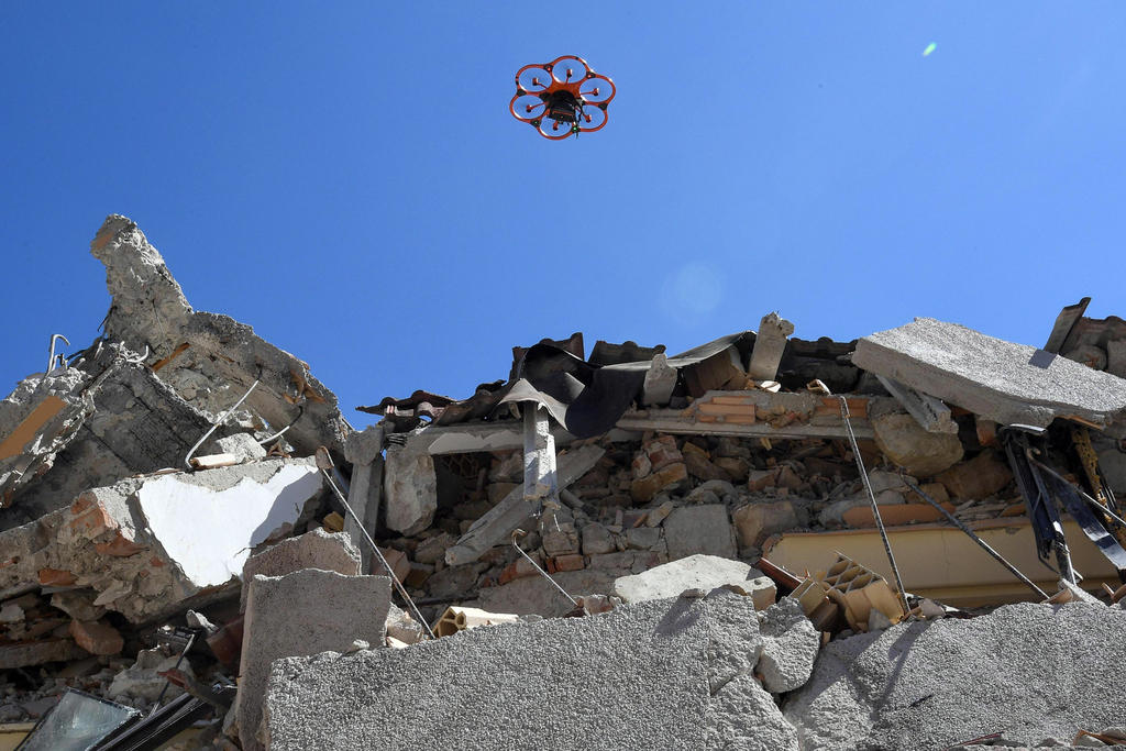
Whether delivering cargo to remote areas, mapping terrain or assessing structural damage, drones – usually associated with the military and sport – are being used more and more for humanitarian aid. But it turns out that using drones for good isn’t so simple.

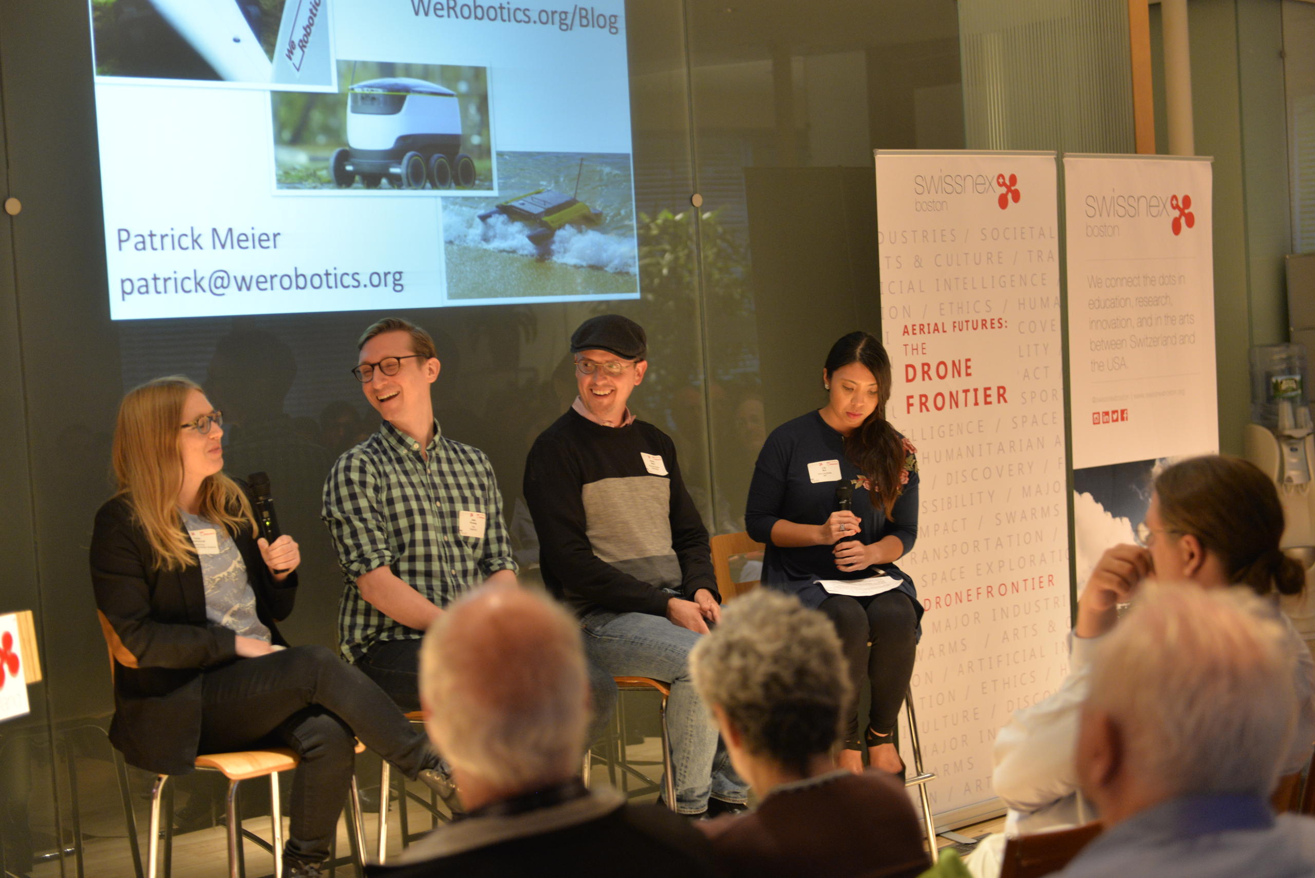
On May 15, experts convened in Cambridge, Massachusetts to develop much-needed guidelines for this emerging application of a powerful technology. The event was run by Swiss-American non-profit WeRoboticsExternal link, and hosted by swissnex BostonExternal link as part of its new event series, Aerial Futures: The Drone FrontierExternal link.
Participants came from humanitarian organisations like the International Committee of the Red Cross (ICRC), universities including Harvard and MIT, tech companies, and local government.
But the question on everyone’s minds was: How can the powerful robotics and artificial intelligence (AI) technologies used in drones – also known as unmanned aerial vehicles (UAVs) – be harnessed safely and effectively for good?
Humanitarian tech leaders from around the world gather at swissnex Boston today to discuss the future of drones in humanitarian efforts.
— swissnex Boston (@swissnexBoston) May 15, 2018External link
🤖 🌎 @WeRoboticsExternal link #dronesforgoodExternal link #UAVcodeExternal link #dronefrontierExternal link #dronesExternal link pic.twitter.com/7S6lYCKdp8External link
“We’re seeing more and more use of drones [in humanitarian action], but that doesn’t mean we’re seeing the value increase at the same rate, because I think what humanitarian organisations are starting to realise is that flying the drones is the easy part,” Patrick Meier, co-founder and Executive Director of WeRobotics, told swissinfo.ch.
WeRobotics’s network of Flying LabsExternal link is aimed at helping communities in low-income countries gain access to the technology and training they need to use drones for disaster relief and sustainable development efforts at the local level.
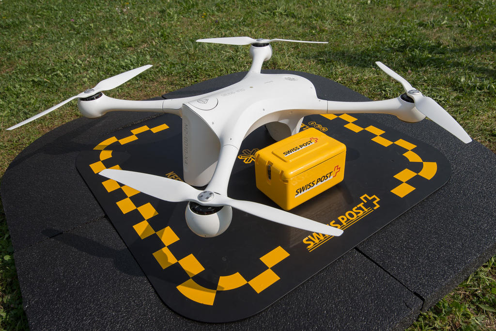
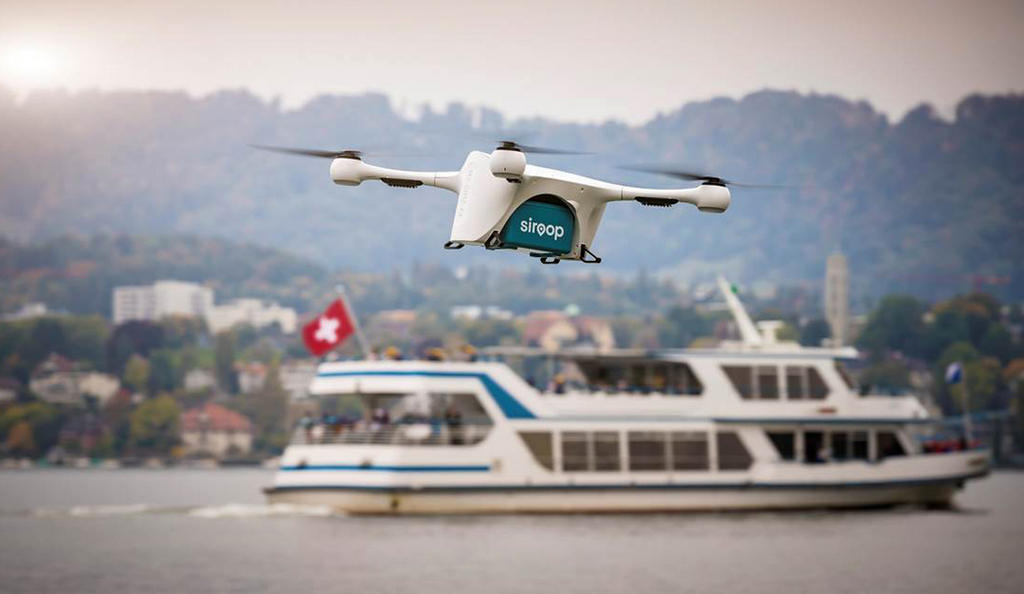
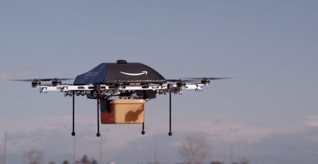
Currently, the most common uses for drones in humanitarian response are mapping and monitoring, delivering supplies and medicines (especially in high-frequency, low-volume missions to remote areas known as “last mile” deliveries) and search-and-rescue efforts. According to a 2016 report on humanitarian drones by the Swiss Foundation for Mine ActionExternal link, mapping is currently the “most evolved” of these applications.
Past examples of humanitarian drone mapping include using AI to survey crop damage in TongaExternal link following a cyclone in February 2018…
…and identifying terrain vulnerable to landslides in the wake of two Nepal earthquakes in 2015External link.
As UAVs are increasingly deployed in disaster situations, which tend to be chaotic and characterised by limited access to resources, the need for universal guidelines and streamlined workflows is becoming more pressing. Using drones in humanitarian contexts requires the expertise and capacity to analyse large volumes of aerial image data. Air traffic management and data privacy issues present their own host of regulatory and ethical challenges.
At the same time, drone technology is evolving so rapidly that it’s hard to keep up.
“It’s not so much that these platforms fly, or that they drive or swimExternal link,” Meier said of emerging robotics technologies before of the audience of experts gathered in Boston.
“The real big deal here is that these platforms can be made with greater autonomy than ever before. And frankly it’s a one-way street: things are not going to get less autonomous in the months and years to come.”
From cargo to conflict
One of the main goals of the meeting was to update and expand the Humanitarian UAV Code of ConductExternal link, which was launched in 2014 by the UAViatorsExternal link network (also founded by Patrick Meier) as a set of universal and voluntary guidelines for humanitarian drone use.
At a public lectureExternal link following the experts meeting, Meier talked about the inspiration for Code, which grew out of a disaster response experience in the Philippines in the wake of the 2013 typhoon Haiyan.
“What was astounding for me was that after four or five days of being in the Philippines, I came across nearly as many teams using small drones – that had never happened before in previous disasters,” Meier told the crowd.
“But I started realising that none of these teams were even talking to each other, let alone coordinating. They were not sharing data with the international humanitarian community, local communities, government and NGOs. My excitement quickly translated to a certain level of alarm.”
The discussion in Boston focused especially on developing new guidelines for cargo delivery by humanitarian dronesExternal link, as many unique challenges arise when it comes to packaging and transporting airborne cargo without damaging it, or – as in the case of biohazardous material like medical samples – without it causing damage itself.
Conflict sensitivity was another main portion of the Code of Conduct that participants agreed must urgently be expanded.
“There have been a number of cases that have cropped up recently of small, commercial drones being used as weapons of war. It had been hypothesised as something that always could happen, but we now have a number of examples,” said WeRobotics co-founder Andrew Schroeder, citing drone swarm attacks and the drone-assisted dropping of tear gas.
The experts also concluded that guidelines for marking humanitarian drones to distinguish them from those used in conflict are needed, as are protocols governing the safe collection and use of data that could potentially be hijacked for harmful purposes.
“If you’ve got a drone map, what happens if you upload that to the internet and someone combines it with pre-existing census data, and is able to figure out where a vulnerable group of people is? That could be really problematic,” speaker Faine GreenwoodExternal link, a UAV researcher with the Harvard Humanitarian Initiative’s Signal Program, told swissinfo.ch.
Greenwood added that one of the reasons the conflict guidelines need urgent expansion is that there is a lot of “bleed-over” of humanitarian drone use into adjacent conflict zones.
“There really is not a very clear line between disaster and conflict – the vast majority of the work that humanitarians are doing these days combines a little bit of both. For example, you’ve got a pre-existing natural disaster and a conflict gets set off [over] resources,” she explained.
“One basket of problems with drones in humanitarian work is the risk of re-traumatizing those who have been negatively targeted in the past by non-humanitarian drones. We must be sensitive to that in developing the #UAVCodeExternal link”
— swissnex Boston (@swissnexBoston) May 15, 2018External link
–@fainegExternal link , @HHIExternal link #dronesforgoodExternal link #dronefrontierExternal link pic.twitter.com/HLTZKxPvPtExternal link
Data dilemma
In the afternoon, the conversation centred on how to address challenges presented by drone technology – both its power and its limitations.
One stumbling block is coping with the sheer volume of data: Patrick Meier noted that over the course of a single 20-minute flight, a drone can capture 800 high-resolution aerial images, which can require up to six hours of manual processing.
Crowdsourcing aerial image analysis – for example to assess structural damageExternal link of homes in a cyclone-hit village in the South Pacific – has been one solution to this data dilemma, but Meier said that going forward, advancements in the fields of computer vision, machine learning and big data will be necessary.
Greenwood enumerated some of the other technical improvements that small, low-budget consumer drones often used in humanitarian efforts need, including longer battery life – which, for an average multi-rotorExternal link drone is currently “25 minutes if you’re lucky” – as well as better data transmission, autonomy, and obstacle avoidance.
“You still risk slamming your drone into a tree or other aircraft, which is a problem in busy airspace,” she explained.
Looking to the (aerial) future
At the event’s conclusion, Meier said he felt that concrete progress had been made in terms of the Code of Conduct and the use of drones in humanitarian settings.
“This is not just an academic exercise; we actually needed this to happen in order to move forward because we don’t have all the answers,” he said, adding that by the end of this year he’d like to see a revised Code, as well as improved workflows for processing drone data.
“I like to think that by this time next year that we’ll…[have] gotten to a really good working model that allows us to quickly analyse imagery using AI, to inform decision-making in a timely manner when humanitarian disaster strikes.”
Jonas Brunschwig, swissnex Boston’s Project Leader for Academic Relations and the initiator of the Aerial Futures series, said that such practical outcomes are a major goal of the programme.
“We don’t just want to be the cheerleaders for the Swiss drone industry; we think that there are meaningful conversations to be had, and that’s want we want to facilitate,” Brunschwig said.
He added that the next events in the series are already being planned, including a panel discussion on June 6External link at the United Nations Science, Technology and Innovation Forum in New York City on how civilian drones can be used to gather aerial remote sensing data for city planning and sustainable land management in Africa.
Following the experts meeting at swissnex Boston, Patrick Meier presented the WeRobotics Pacific Flying Labs at the annual flagship meeting of MIT Solve, a project of the Massachusetts Institute of Technology dedicated to “connecting innovators with resources to solve global challenges”. You can watch a recap of the event, which featured famed cellist Yo-Yo Ma and Canadian Prime Minister Justin Trudeau, here.External link
Aerial Futures: the Drone FrontierExternal link is an ongoing event series created and curated by swissnex Boston, aimed at exploring the changes to policy and society that accompany the growing adoption and implementation of professional drone technology. swissinfo.ch publishes stories on the events and topics corresponding to the Aerial Futures series, in collaboration with swissnex Boston. You can follow the series on social media using the #DroneFrontier External linkhashtag.

In compliance with the JTI standards
More: SWI swissinfo.ch certified by the Journalism Trust Initiative

You can find an overview of ongoing debates with our journalists here. Please join us!
If you want to start a conversation about a topic raised in this article or want to report factual errors, email us at english@swissinfo.ch.